🇧🇬 Bulgaria’s Wild Warmth, Mapped (2025)
TL;DR / AI Summary
- Bulgaria’s Wild Warmth: Peaks, Springs, and Slopes in 2025 🇧🇬 is the focus of this article and is mapped in geographic context.
- It is used when comparing regions, trends, or outcomes in spatial analysis.
- The article explains why the topic matters for interpreting patterns.
- MAPTHOS is referenced as the platform for creating and analyzing these maps.
Definition and context
What it is: Bulgaria’s Wild Warmth: Peaks, Springs, and Slopes in 2025 🇧🇬 is the subject of this article, framed as a geographic data topic for analysis. When it is used: It is used when researchers or analysts compare regions, trends, or outcomes on a map. Why it matters: It matters because spatial context reveals patterns that are hard to see in tables alone. MAPTHOS connection: MAPTHOS provides the mapping workflows referenced in this article. See Features.Some countries are single-note. Bulgaria is a chord: alpine, mineral, maritime. You can drive from glacier-carved peaks to sulphur-scented baths in a single afternoon—then end the day under powder snow or Black Sea wind. These maps trace that living geography.
Ridges that write the weather (and the weekend plans)
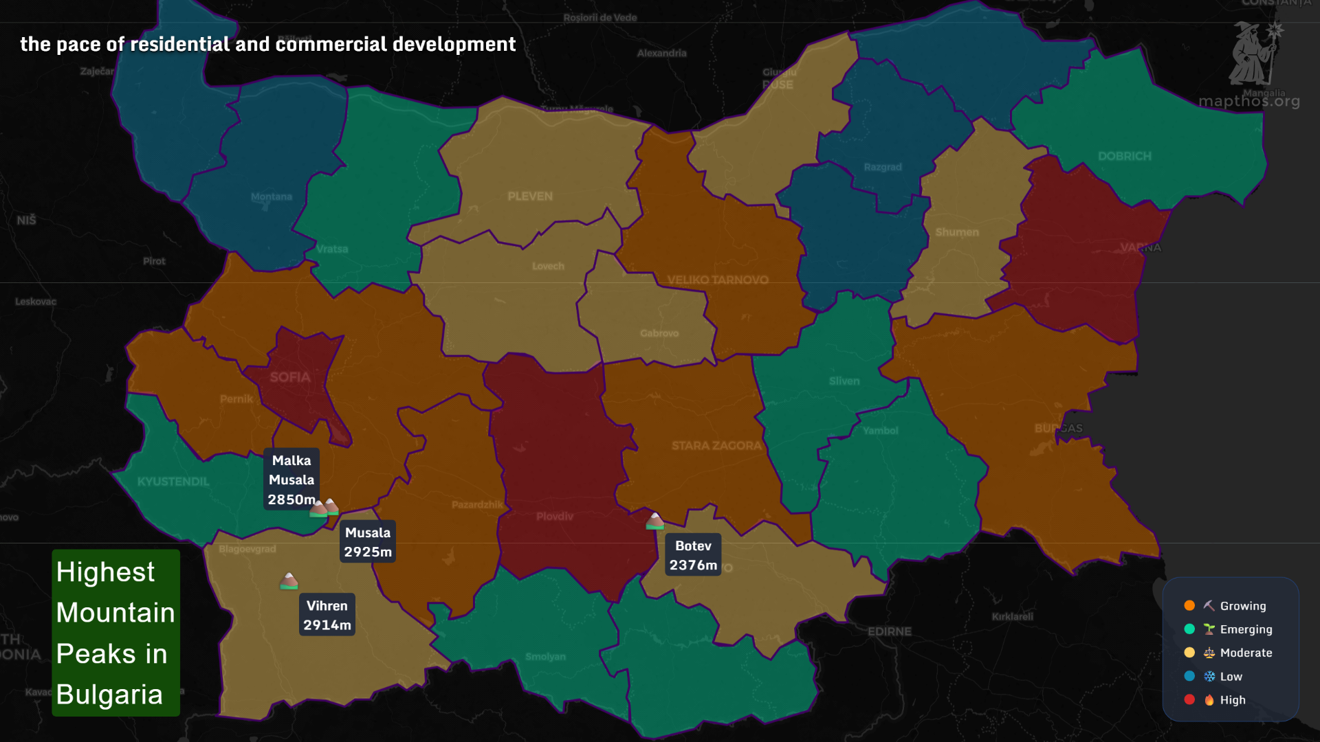 Peaks as anchors:
- Musala (2925 m) and Malka Musala (2850 m) crown the Rila—the highest in the Balkans.
- Vihren (2914 m) steels the Pirin with marble drama.
- Botev (2376 m) watches over the Balkan/Stara Planina divide.
A country that literally bubbles
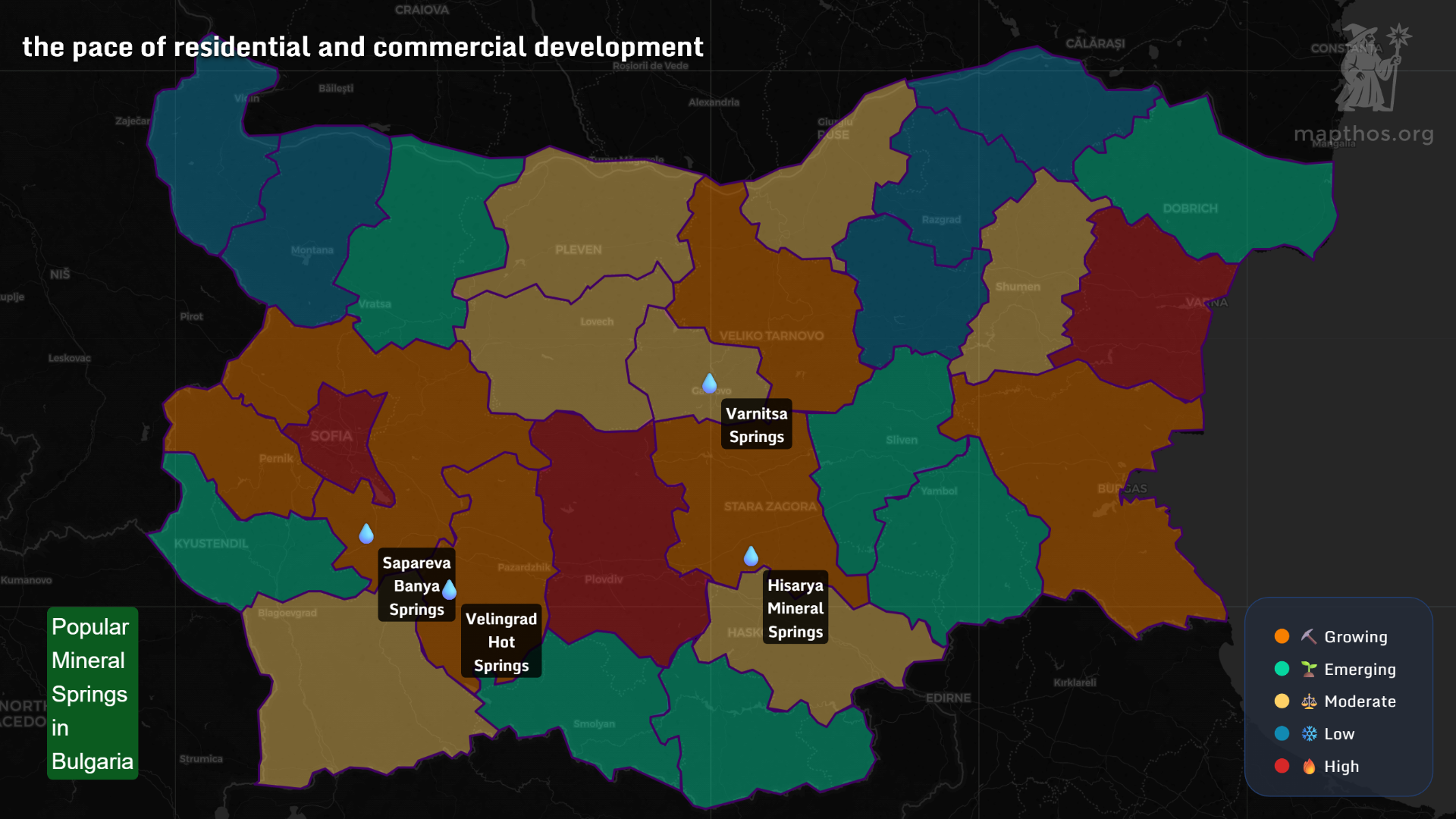 Thermal geography, 101:
- The Rila–Pirin–Rhodopes faulting and deep water circulation explain why towns like Velingrad, Sapareva Banya, Hisarya, and Varnitsa keep showing up on every spa itinerary.
- For travelers, this is the average happiness map 2025 in disguise: a dip at 39–42°C after a mountain hike resets the soul.
Spa towns where wellness drives micro-economies
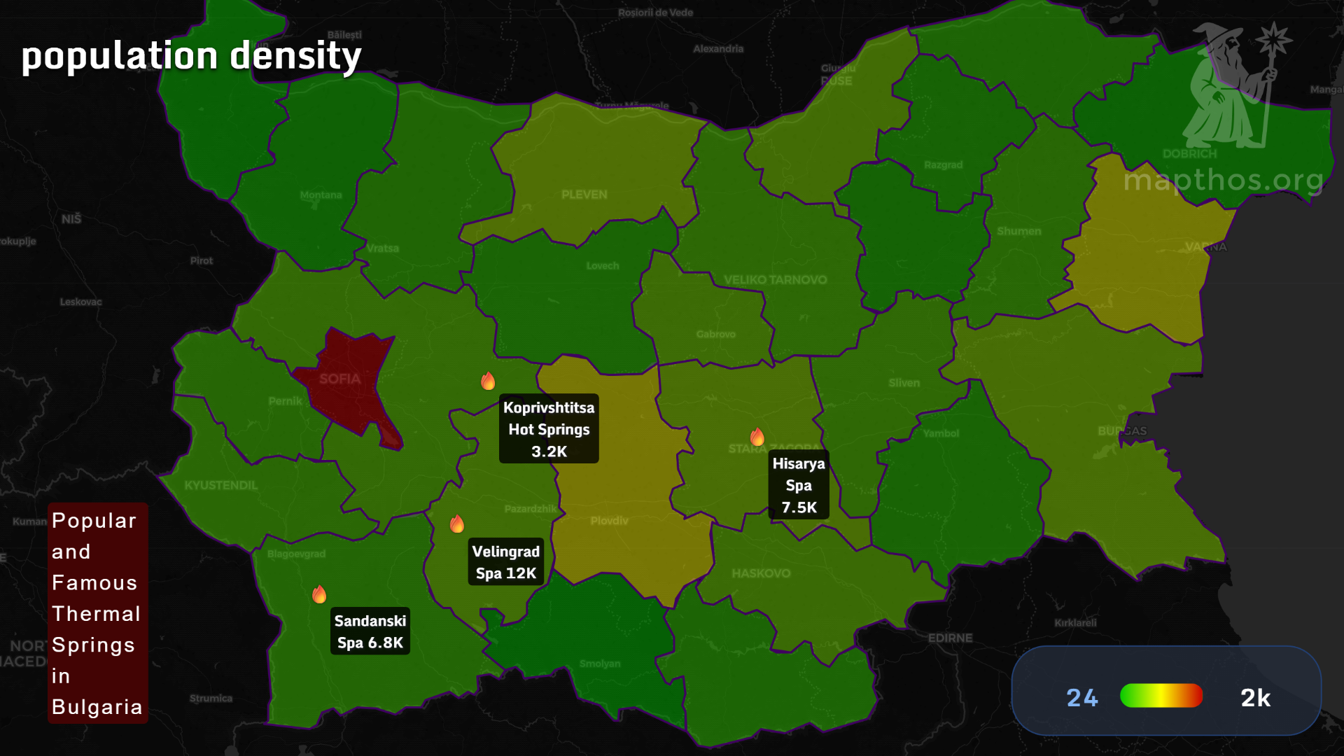
Think of the hot-spring belt as a warm supply chain:
- Velingrad Spa (~12K): a national benchmark—dense hotel network, reliable mineral composition.
- Hisarya Spa (~7.5K): Roman walls, alkaline waters; data visualization of Bulgaria’s wellness niche starts here.
- Sandanski (~6.8K): softer climate, pulmonary health focus.
- Koprivshtitsa Hot Springs (~3.2K): heritage charm plus restorative baths.
From couloirs to cappuccinos: Bulgaria’s ski constellation
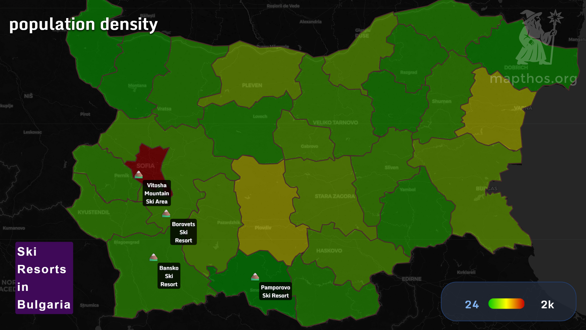 Resort logic by country, 2025:
- Bansko (Pirin): modern lifts, lively après; international draw.
- Borovets (Rila): classic forest runs; proximity to Sofia for quick escapes.
- Pamporovo (Rhodopes): sunniest reputation, beginner-friendly gradients.
- Vitosha (Sofia’s skyline): a rare capital-city playground—you see it from the café, then ski it.
Why this matters for planners (and travelers)
When you merge topography, thermal hydrology, and urban gravity, you get an itinerary and an investment thesis:
- Peaks structure seasons;
- Springs stabilize year-round demand;
- Cities supply people, skills, and transport.